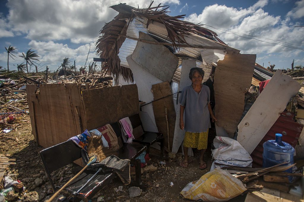
 GUIUAN, Eastern Samar Province, Republic of the Philippines (Nov. 15, 2013) A Guiuan woman stands outside of her makeshift shack in the aftermath of Super Typhoon Haiyan. The George Washington Carrier Strike Group supports the 3rd Marine Expeditionary Brigade to assist the Philippine government in Operation Damayan in response to the aftermath of Haiyan in the Republic of the Philippines. (U.S. Navy photo by Mass Communication Specialist Seaman Liam Kennedy/RELEASED).
 Social media, driven by the explosive uptake of mobile computing, has caused a systematic shift in the structure of personal communications on a global scale [1], [2]. People around the world can now voice opinions, report on events, and connect with others, with an ease unthinkable in the pre-Internet age. From the Arab Spring to the Occupy Movement it is apparent that social media is becoming an integrated part of our infrastructure. Critically, much of this information is underpinned by geographical content such as mobile device GPS coordinates, which enable the user to tie their media to a specific location on the Earth’s surface.
Due to the immediacy of social media messages, social media is often used during disasters where locational information is of vital importance [3], [4]. At the time of this writing, an army of online enthusiasts, professionals and volunteers are painstakingly creating detailed maps of the Philippines for emergency relief efforts in the wake of Typhoon Haiyan [5]. These virtual online communities, centered around projects such as OpenStreetMap, are effectively harnessing the Internet for crowd-sourced map production. While typically this type of information has been defined as “volunteer geographic information” (VGI) [6], the increasing interest in using social media as a medium for crowd-sourcing real-time situational data during crises is blurring the definition. A number of software platforms that act as hubs for information reporting via social media networks during emergencies, have been developed around this concept. Such systems are particularly prevalent in developing nations where traditional, formal communication and media networks can be limited. Ushahidi is one such platform that enables automated report creation by monitoring keywords on social media networks to create an online, real-time, spatio-temporal interface for situational awareness during an emergency [4].
The populations of these settlements will bear the brunt of the climatic, economic, and social challenges of the 21st century.
In contrast to VGI and crowd-sourced data, the nexus of people and place embedded within everyday social media is forming a source of “ambient” geographical information [7]. This “geosocial” media is increasingly being investigated by researchers as a new data-source for analysis [1], [7], [8]. For example, Crooks et al. [1] demonstrated the ability to map the spread of an earthquake in the United States using 21 362 geolocated tweets. The study showed that the first tweet appeared 54 seconds after the earthquake, with further tweets corresponding in location and time with distance from the epicenter [1].
In this new paradigm, social media are effectively forming a human-powered sensor network, which can be used to supplement existing, formal geographical data-sources for situational awareness [1], [7]–[8][9]. The research challenge now is to leverage the potential of this new global network of intelligent sensors outside the realm of disaster response.
One of the most exciting prospects for geosocial media is its ubiquity around the world, including its widespread adoption by the urban poor in many developing nations [2]. Furthermore, if we widen our definition to include information from the aforementioned VGI and self-reporting projects like Ushahidi, then the resulting data is nothing short of astounding; geosocial media provide, for the first time, an unrestricted insight into the lives of millions of the poorest people on the planet.
As the rural poor, driven by globalization, flock to cities in search of work [2], [10], urbanization has become synonymous with slum growth [11]. Slums emerge in developing nations as sprawling centers of informal and unplanned infrastructure [11]. Due to the poor infrastructure provision (e.g., housing, water, sanitation) and limited resources, the populations of these settlements will bear the brunt of the climatic, economic, and social challenges of the 21st century [2], [12]. The situation is further complicated by the inherent lack of information regarding people and infrastructure in slums due to their informal nature. Yet, if we are to improve conditions in the 200 000 slums around the world [10], and mitigate the impacts of significant change, we need to better understand these informal urban systems. Crucially, such research needs to engage with members of each community in an open manner, to understand the complexity of interactions between inhabitants, resources, and the urban fabric [13].
Our hypothesis is that geosocial media has the potential to act as a data source for models of the urban system. Such models could be used to either investigate ways to improve the current situation, or quantify how the system will respond to change. The cornerstone for this research is that many slum communities are already using VGI and social media to capture geographical information about infrastructure and populations in their settlements, and are openly sharing this data on the Internet. As such our research is currently focused on developing the methodologies required to harness this data, and use it for urban systems analysis. This research is employing data from two cities: Nairobi, Kenya, and Jakarta, Indonesia. In Nairobi residents of Kibera formed the Map Kibera project to create the first map of the slum, providing, new and invaluable data on the location and distribution of infrastructure in the settlement [14]. Thus, using only data provided by Map Kibera and Open-Street Map we successfully built a spatio-topological model of the road network for Kibera and surrounding Nairobi. GIS network analysis techniques were then used to optimize a road-based sanitation network for Kibera’s public latrines [15]. The novelty of this project is the ability to apply GIS techniques, commonly used in data-rich developed nations, in a developing nations context to help solve an engineering problem.
The next stage of this research is to interweave situational reports on infrastructure from social media together with urban network models. The case study for this is Jakarta, where communities in urban slums along riverbanks are using social media and SMS texts to warn neighbors of rising floodwaters and failures in flood defenses. We are developing a suite of tools to capture and interpret this data, using a sensor network paradigm to extend and improve existing models of the river network during flood events.
In conclusion, while there are still significant research challenges in this emerging field, geosocial media has the potential to provide a novel source of data to understand complex urban systems in informal settlements. Such understanding is key to researchers so that they may provide tangible adaptation strategies to those on the front-line of global change.
Author
Tomas Holderness is a Geomatics Research Fellow at the SMART Infrastructure Facility, University of Wollongong, Australia. Email: tomas@uow.edu.au.


 JOIN SSIT