


It can be easy to explore the dark side of technology while not highlighting the benefits. But over the past few months, I came across a number of volcano and technology memes that led me to reconsider some of the benefit for humanity that technology promises.
I visited Yellowstone National Park a few times this year. My childhood visits preceded the awareness that Yellowstone is one of the world’s largest super volcanos. Today this fact is featured in the Park’s displays and gift stores and visible on the ground in many ways. Yellowstone officials indicate that an eruption is not likely in the next thousand years, but your mileage may differ. Most interesting is the discussion of the instrumentation that the U.S. Geological Survey has in place to monitor activity in the Yellowstone area, including a real-time web presentation. GPS stations are monitoring 3-D earth movement and arrays of seismographs are tracking the tremors. We may not know quite what to look for, but volcano research spanning the globe will inform our analysis. Don’t hesitate to visit Yellowstone; you won’t avoid the impact in Chicago or New York if this volcano erupts. The ash fall from the eruption 12 million years ago, when the Yellowstone hot spot was headed up the Snake River in Idaho, created Ashfall Fossil Beds State Park in Nebraska a thousand miles east. That’s why they call this volcano “super.”
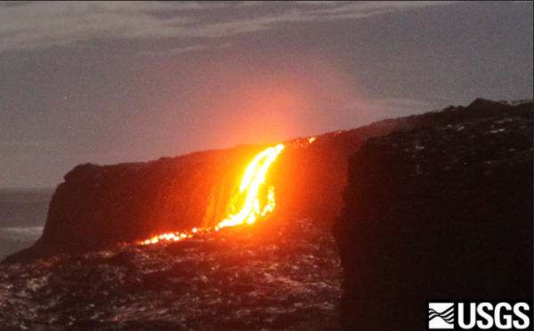
The November 2017 issue of Scientific American has two pieces on the technology of monitoring volcanoes. The main story, “The Next Big Bang” describes the intensive monitoring of the imaging Magma Under St. Helens (iMUSH) effort. If you look at the diverse skills that “geologists” are bringing to the table, you get a sense for the cross-disciplinary aspect of 21st century science. The above tools are part of the mix, but they are have drawn from the petroleum industry’s well-logging technology (blasts set off and “observed” by arrays of seismographs) to get images of the underlying rock structure. This is combined with monitoring solar particles that induce currents though various rock layers (magnetotellurics), along with the work of magnetic field experts, chemists, and classic rock-hammer types. And of course much of the analysis depends on computer analytics, imaging, and no doubt big data in the future. You can watch Mt. St. Helens live on U.S. Forest Service web-cams. Or for more action, check out the webcams at Hawaii’s Volcano National Park.
A second article in the same issue of Scientific American focused on the use of drones to get an “inside look” at Guatemala’s Volcano de Fuego. Drones are often associated with privacy considerations, or warfare, but have significant beneficial uses as well. In this case entering an environment where scientists dare not go, with hourly blasts and monthly eruptions. It turns out that seeing the cone formation and decimation inside the crater provides insight to the more visible external phenomena.
Volcanoes threaten significant populations around the world. Naples is sitting on top of one caldera. The area from Seattle to Portland is under the shadow of number of peaks. Toyko and most of Japan’s population have a delightful view of Mt. Fuji, which last erupted in 1707. Today’s news reflects Mount Agung in Bali, where an eruption is imminent, and routes to safety for the 100,000 nearby residents are unclear since air travel is limited by the ash-smoke being emitted.
In short, technological tracking of our volcanic environments might save thousands or even millions of lives — if people will listen to the science, and if we can provide the technology to help them get out of harm’s way.
 JOIN SSIT